Historical Maps
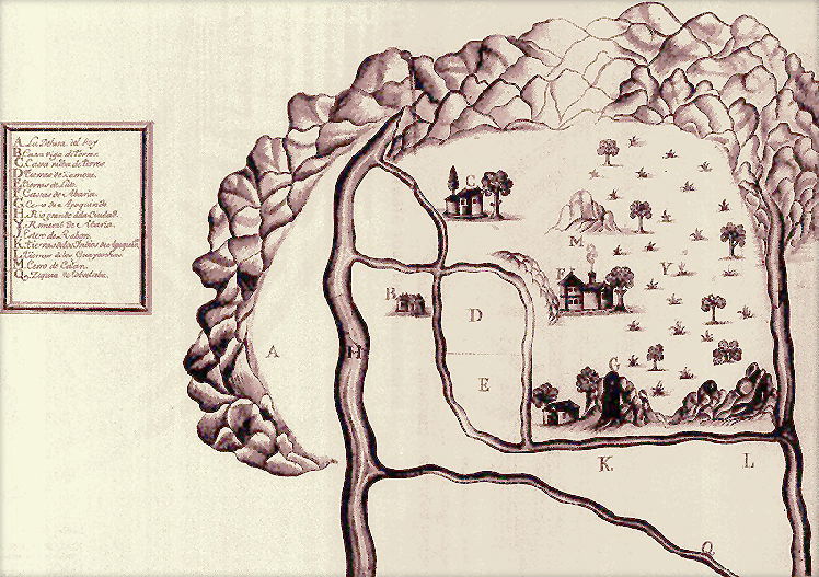
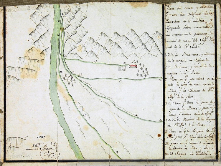

1708 La Dehesa de la Fontecilla
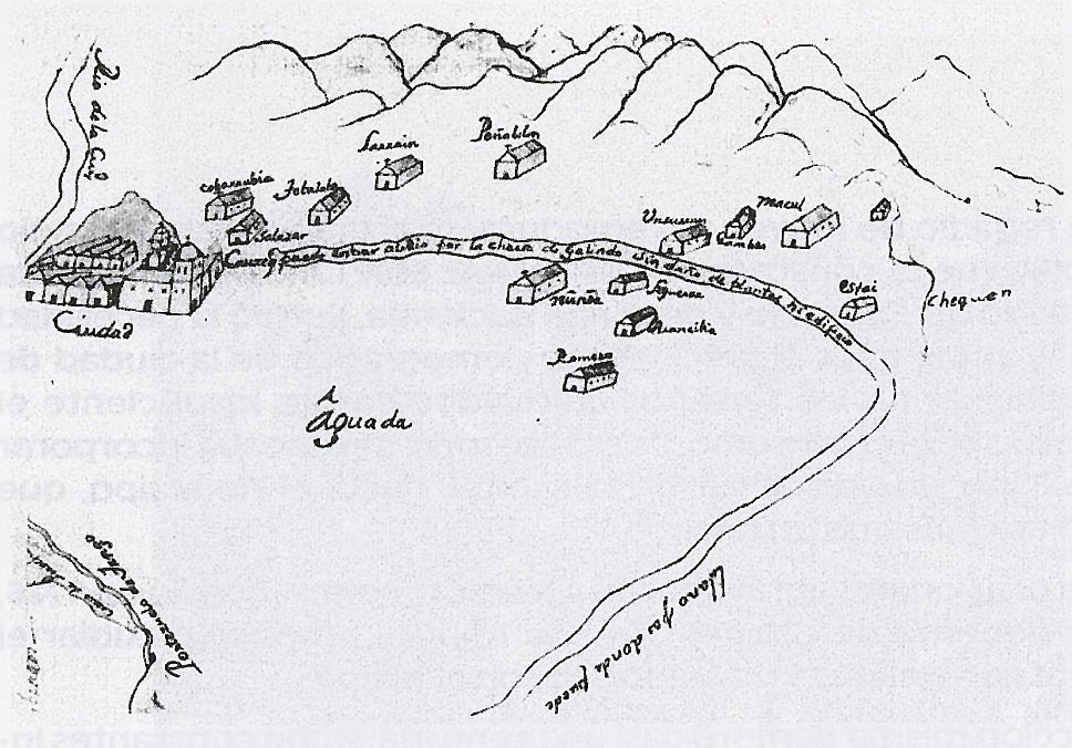
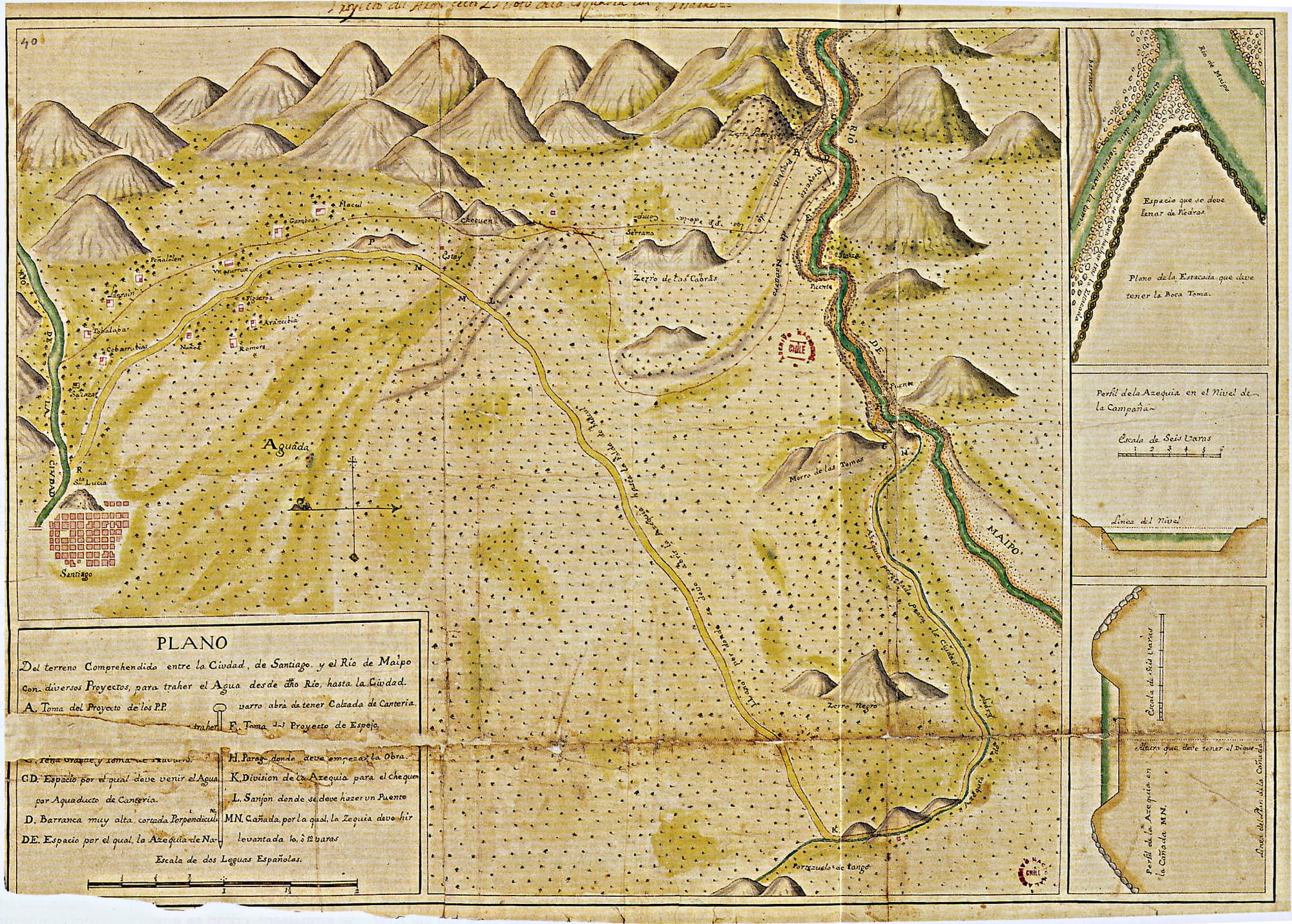
1743 Canal San Carlos Route Plan
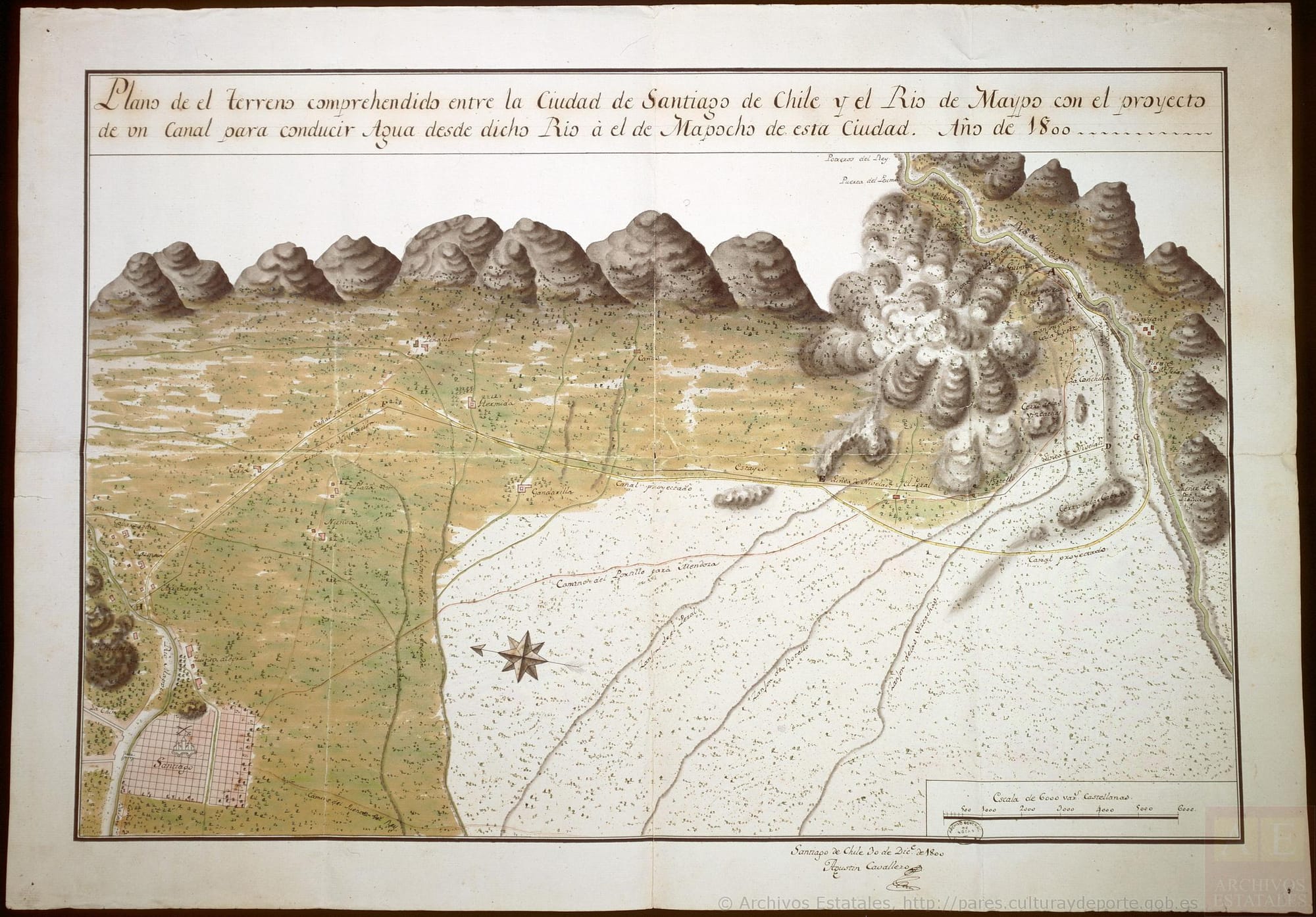
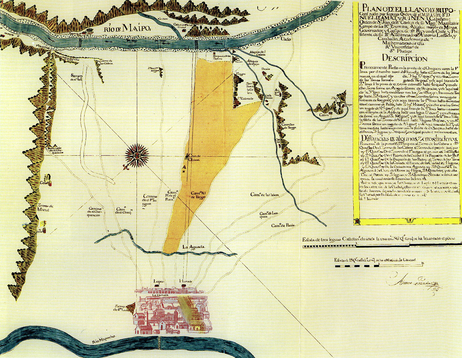
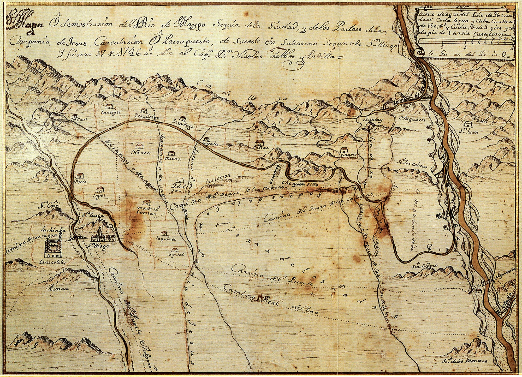
1746 Map and Demonstration of the Maipo River
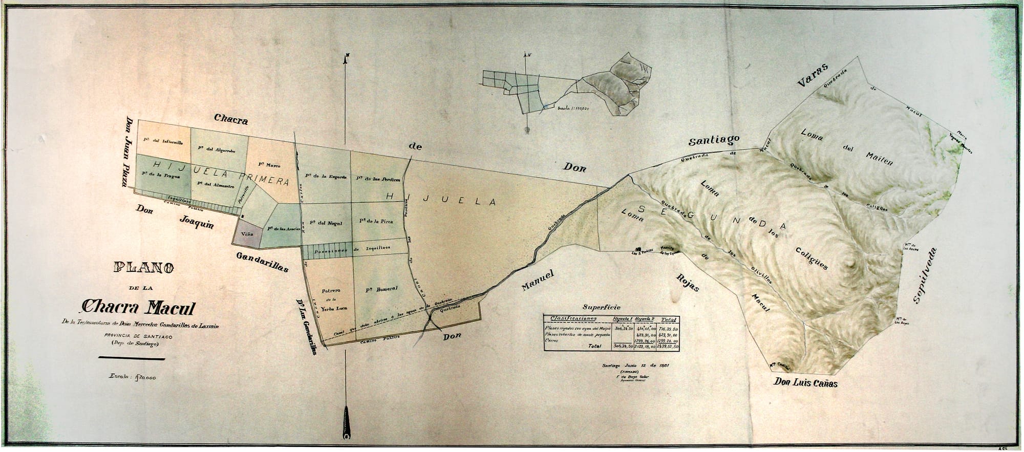
1861 Plan of the Chacra de Macul
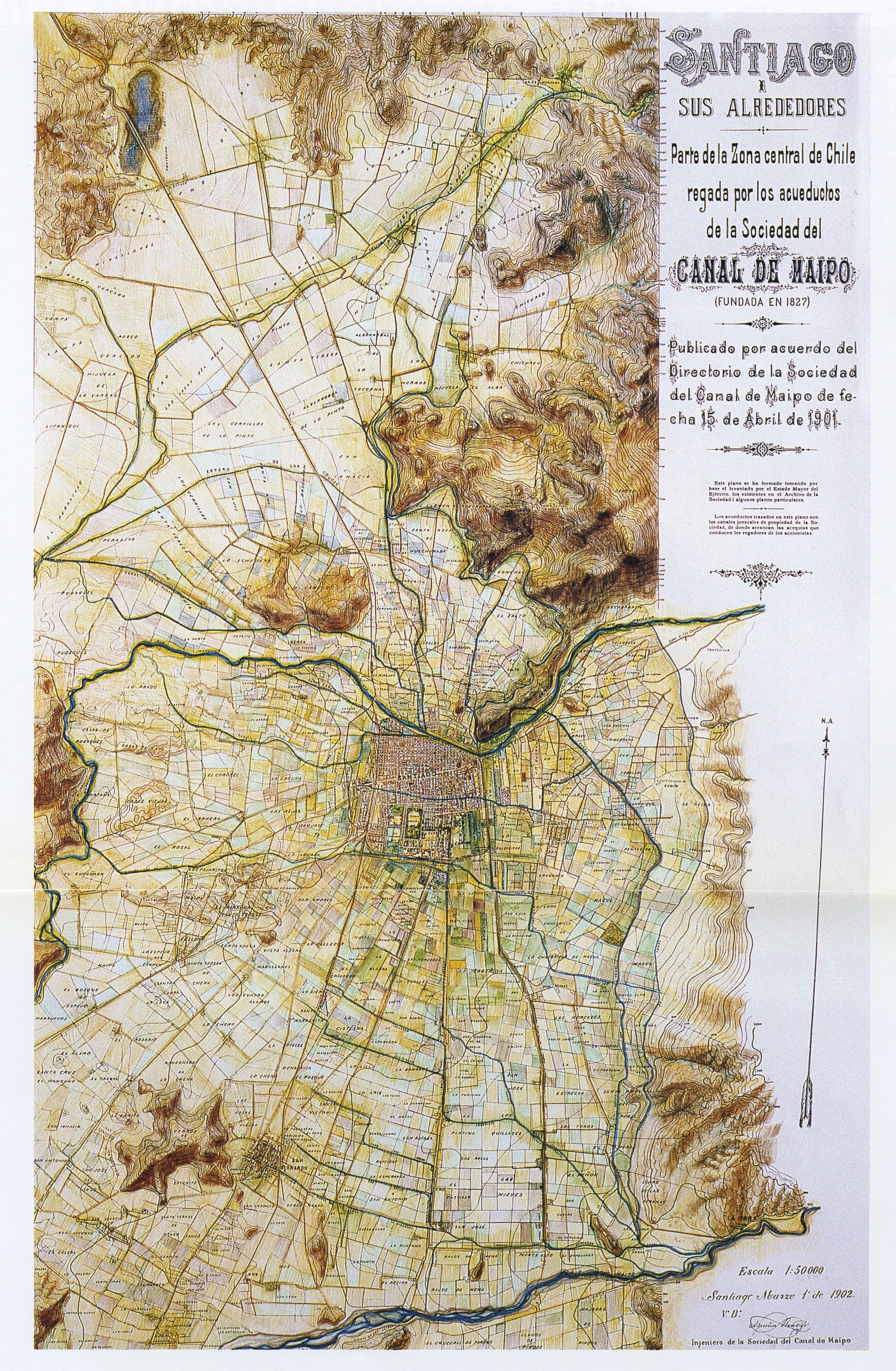
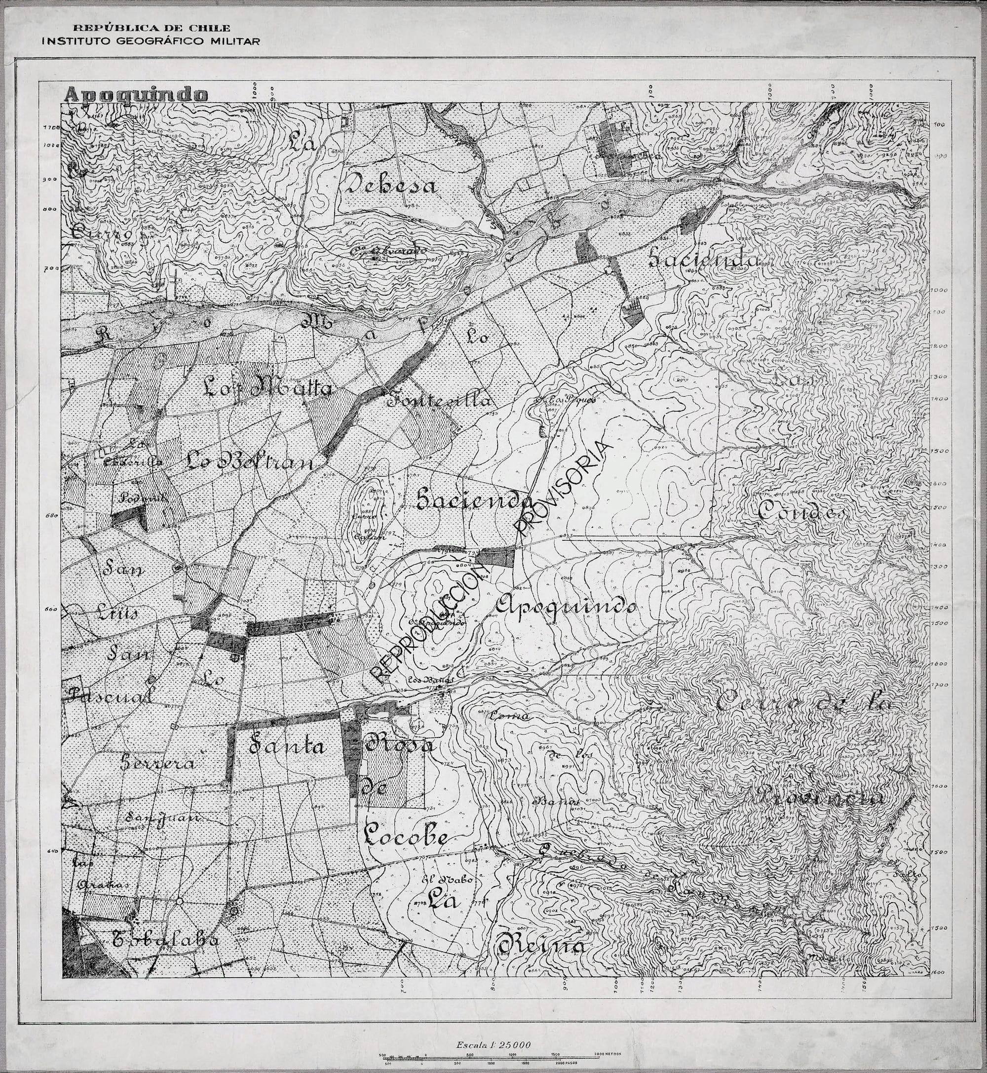
1902 Santiago and surroundings
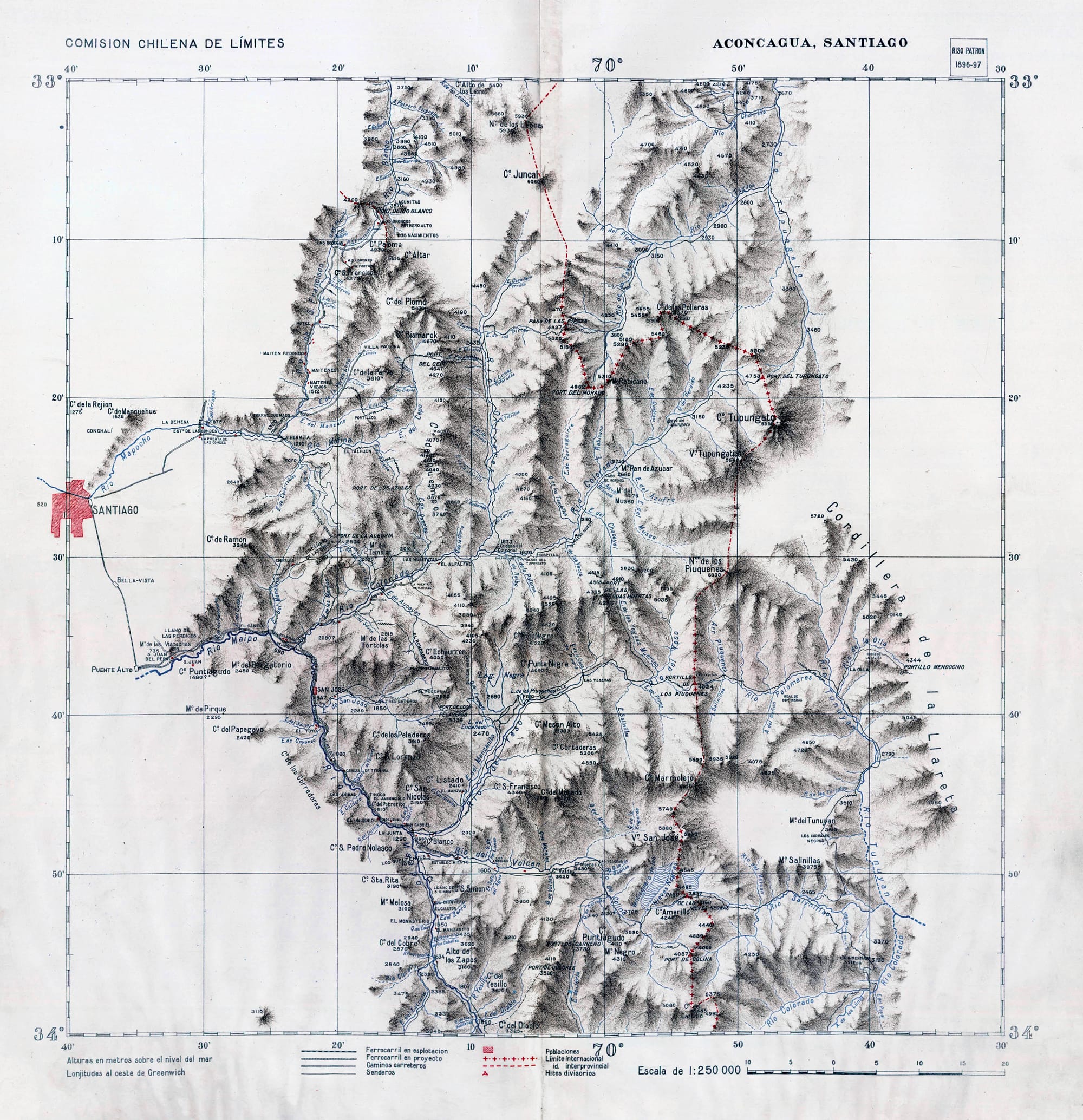
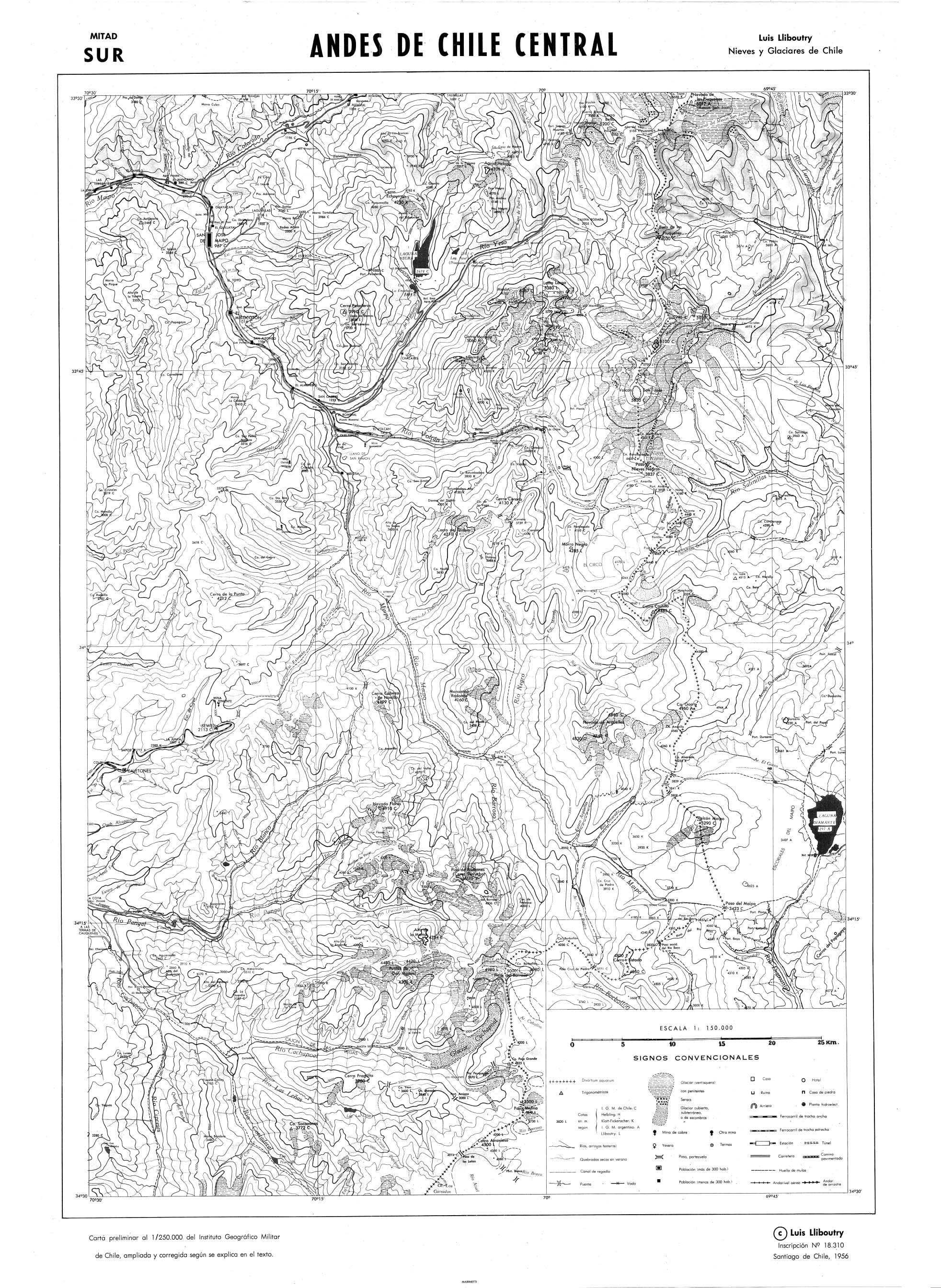
1956 Central Chilean Andes - Southern Half
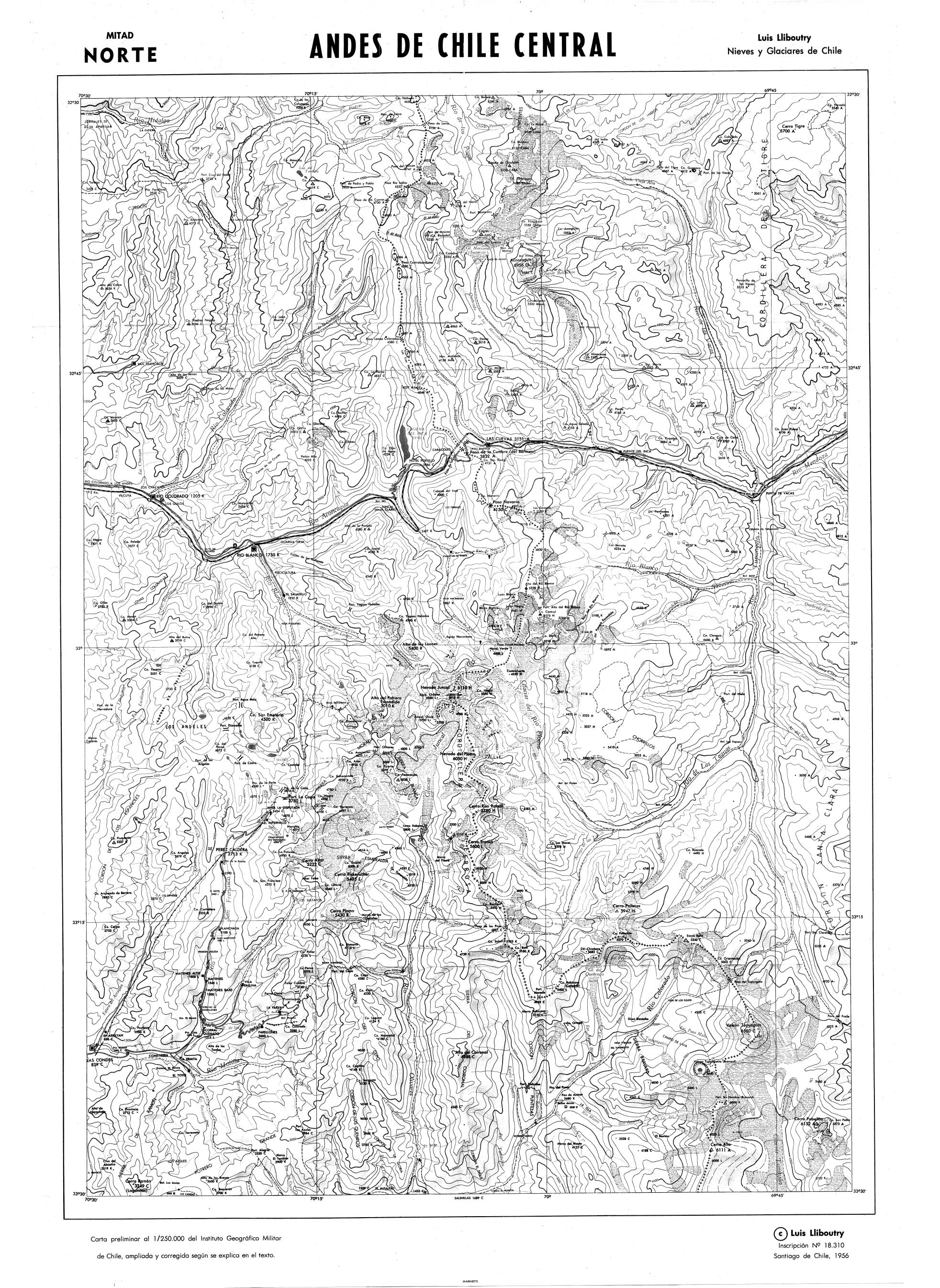
1956 Central Chilean Andes - Northern Half
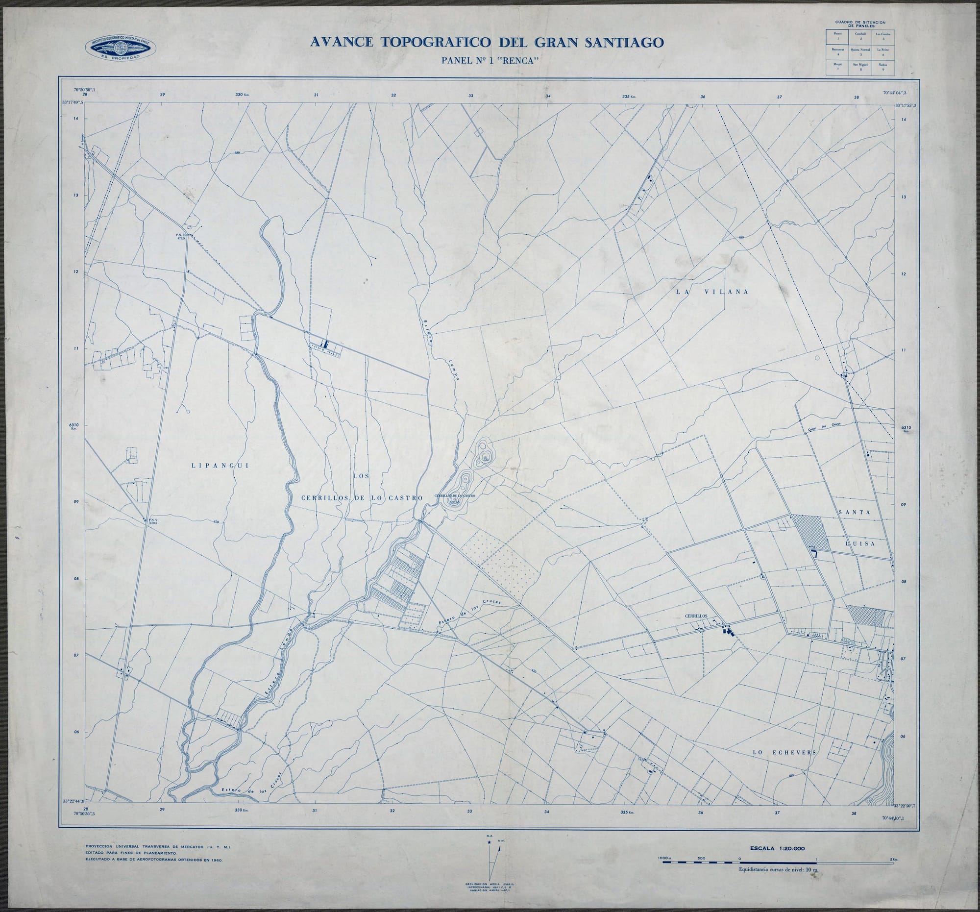
1960 Topographic Survey of Greater Santiago Panel N1 Renca
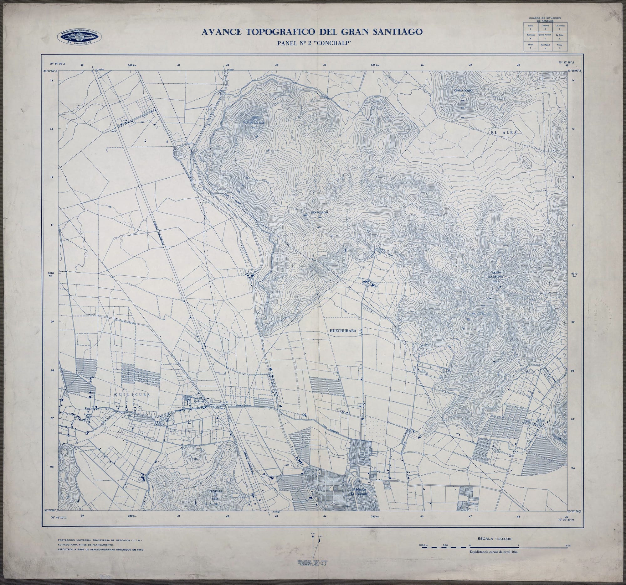
1960 Topographic Survey of Greater Santiago Panel N2 Conchalí
The content expressed in this article is the responsibility of its original authors and does not necessarily represent the views associated with the Panul Para Todos project.
The information archived in Archivo Panul was collected using automated tools, so there may be inconsistencies between what is presented here and the original link. You can visit the original link at the top of this article.